our services

Construction
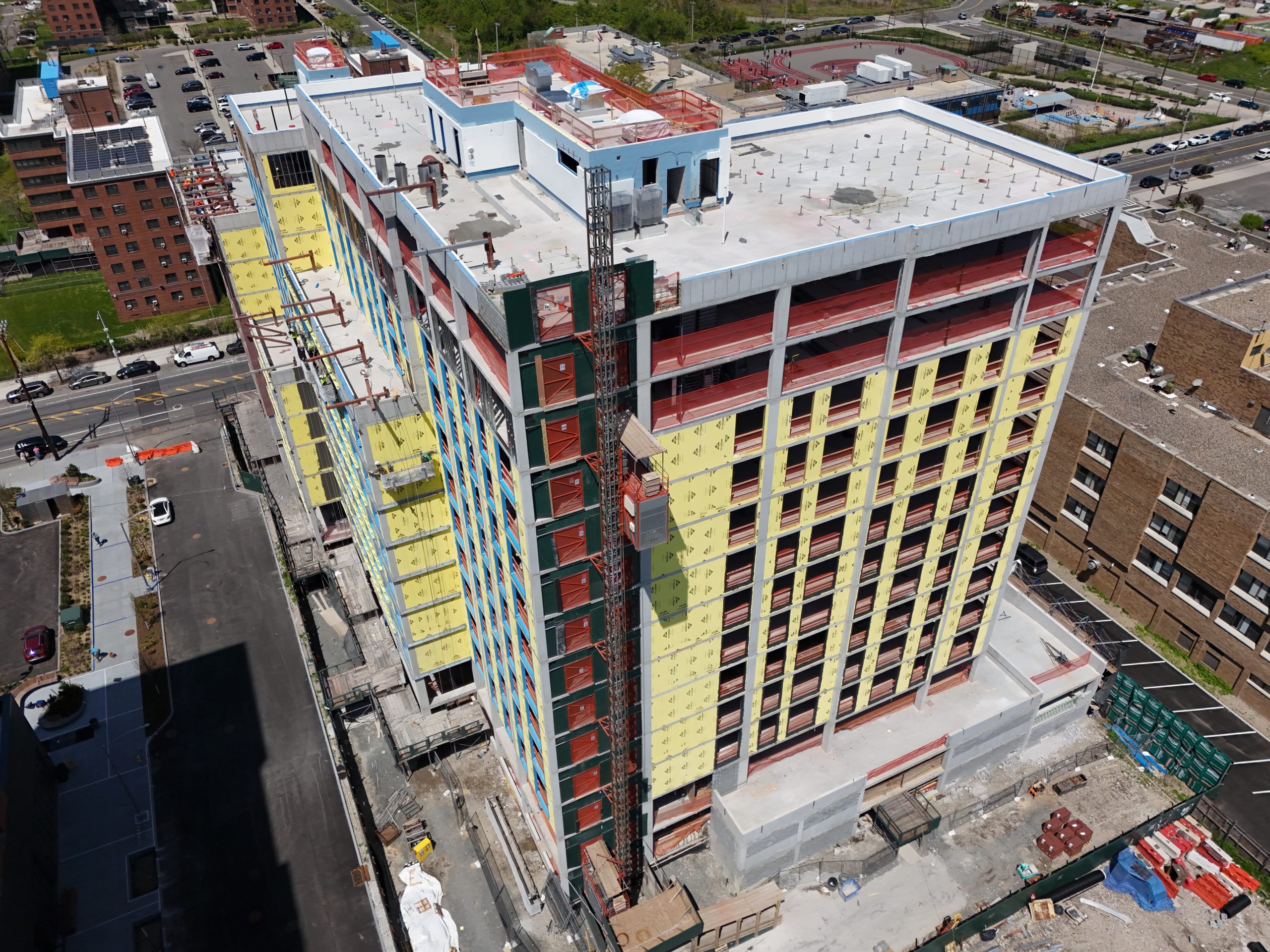
Construction projects are complex, with tight schedules, budgets, and the constant need for clear communication. Ensysta’s aerial imaging services simplify these challenges, providing precise, up-to-date visuals to monitor progress, identify potential issues early, and ensure everyone stays on the same page.
Our high-quality drone photography and 3D mapping allow you to document every critical step of your construction process. This detailed record not only ensures smooth day-to-day operations but also helps avoid costly investigations if unexpected issues arise in the future.
With Ensysta, you gain time, reduce costs, and achieve better control of your project. Let us help you build with confidence, clarity, and peace of mind.
From $300

Drone Mapping
Drone mapping offers a smarter, faster, and more affordable solution for land surveys and site analysis. Traditional methods can be time-consuming and costly, but our advanced drone technology captures detailed data efficiently, enabling you to plan and execute projects with greater precision.
Whether you’re analyzing a construction site, tracking land use changes, or monitoring environmental factors, drone mapping provides the insights you need to make informed decisions. Plus, by documenting every phase of your project, you create a reliable record to reference in the future, minimizing the risk of expensive setbacks.
With Ensysta’s drone mapping services, you save time, cut costs, and gain a clearer perspective for every project.
From $450

3D Models
Our 3D modeling services offer a way to visualize and understand your project from every angle. By transforming drone-captured data into highly detailed, interactive models, we provide an accurate and immersive view of your site that traditional methods can’t match.
Perfect for construction planning, progress tracking, and showcasing completed projects, 3D models help streamline decision-making and enhance communication among stakeholders. Additionally, these models serve as valuable documentation of critical project stages, helping you address potential issues efficiently and avoid costly research down the line.
With Ensysta’s 3D modeling, you gain clarity, confidence, and a dynamic tool to move your projects forward.
From $450
Ensysta Dashboard
The Dashboard keeps your projects at your fingertips, offering centralized access to all your visual data. From high-quality photos and videos to 3D models and mapping outputs, everything you need to track, document, and manage your construction process is in one place.
This easy-to-navigate platform ensures seamless communication, enhances collaboration, and keeps stakeholders aligned at every stage. With all key milestones documented, you can address potential issues efficiently and avoid costly setbacks in the future.
Empower your team with real-time insights, organized deliverables, and complete project transparency through the Ensysta Dashboard. Stay ahead, stay informed, and stay in control.
Included with service

Aerial Media Content
Aerial media content transforms how properties and projects are presented, delivering stunning photos, immersive videos, and 360° virtual tours that captivate and engage. Whether showcasing real estate, capturing progress on a construction site, or creating marketing materials, our drone-powered visuals provide perspectives that leave a lasting impression.
With high-quality imagery that highlights every detail and angle, you can communicate your vision more effectively, attract greater interest, and make informed decisions. Our aerial media content not only enhances visualization but also saves time and resources by offering a clear, comprehensive view.
Bring your story to life and stand out with dynamic, impactful aerial media content tailored to your needs.